Location problems are less related to latitude than length. 3 contours are overlaid in color. Tobias Mayer, publisher Homann’s heirs, Nuremberg, 1750.
1750.
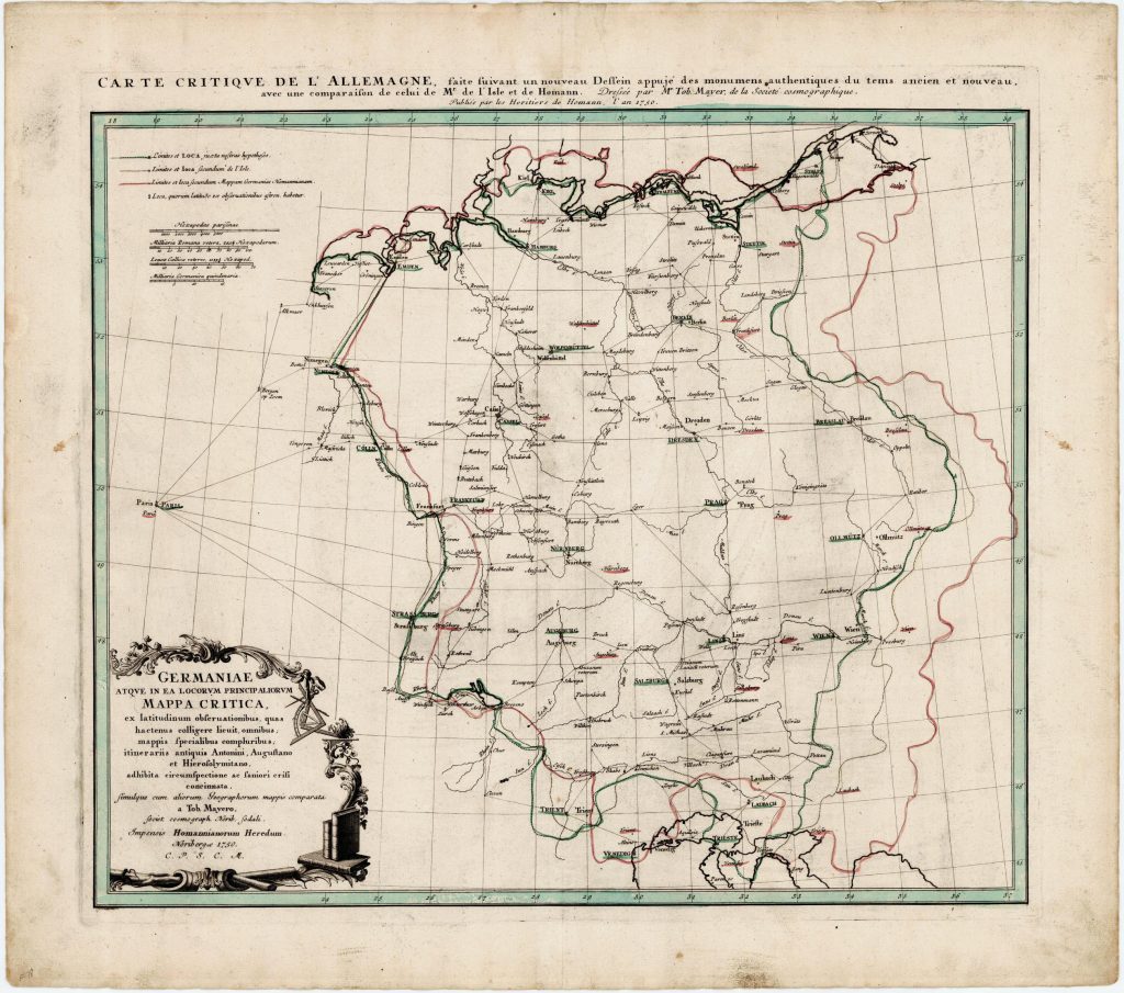
He creates a map of Germany celebrated as a milestone. His so-called Mappa Critica shows inaccuracies, which marked all previous maps of his contemporaries: The longitude was determined until then only unreliably. Mayer uses the measurements of different astronomers and pinpoints places more accurately than other cartographers.
Background-Information:
The cartographic publisher Homanns Erben, the leading cartographic publisher in Germany and Europe in the 18th century, brought the young Mayer to Nuremberg to update obsolete maps. The publishing house was founded in 1702 by Johann Baptist Homann. Homann was a copper engraver whose maps had been widely used for their beauty. In the meantime, the publishing house had been passed on to his heirs and after 40 years many maps were out of date. Tobias Mayer was hired as a research assistant and helped with the over 30 cards he designed the Publisher to new reputation. Mayer used the publishing house and an observatory on Vestnertorbastei, to take own measurements of lunar and star positions, but complained about the poor condition of the devices. Astronomical measurements were of great importance for determining the location of the places you wanted to add to the map.
He creates a map of Germany that has been celebrated as a milestone, the Mappa Critica. In a latitude and longitude net he entered individual places, as he found them on other maps: A map from his publisher (in red), a map of a competitor from France (in yellow) and then the same place with location information, as he had procured by observatories from the whole German-speaking area (in green). The term „Mappa Critica“ thus refers to the critical analysis of the mapmakers data. And his map shows: The details for a location differ considerably. Partially the deviations are more than one hundred kilometers, especially in longitude. Already here one of his later main topics: the exact determination of longitude.