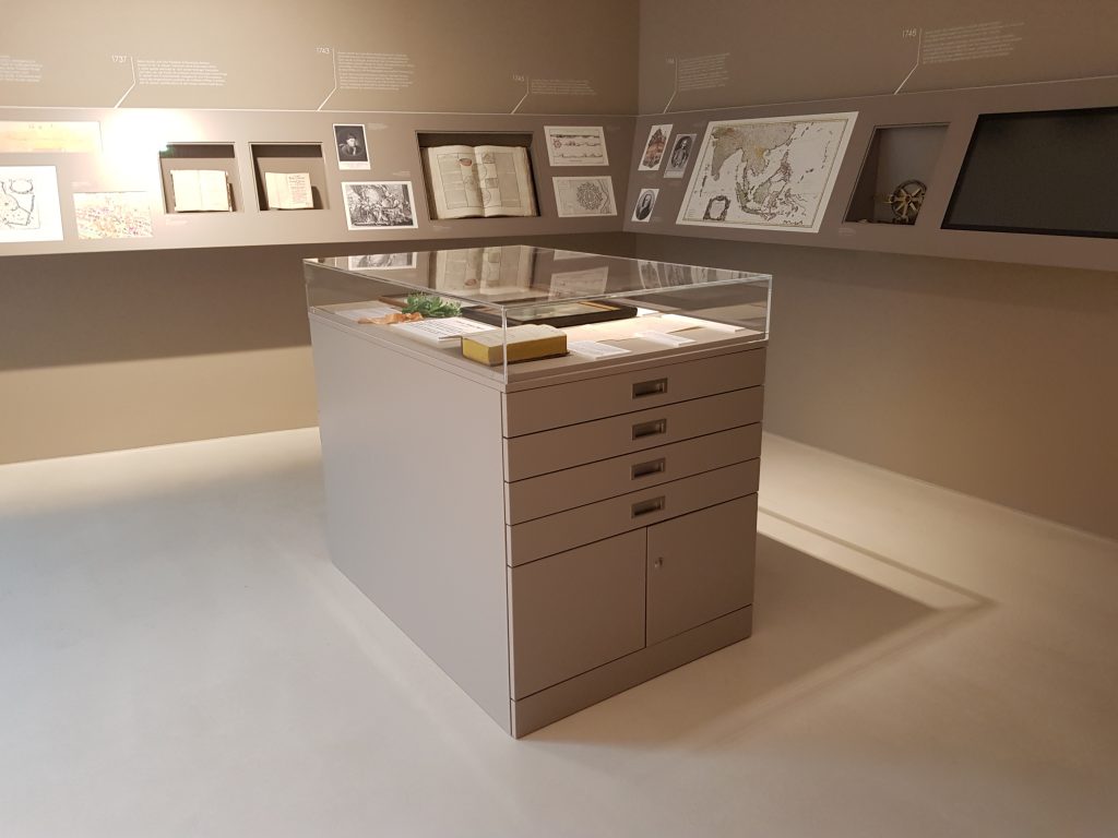
Mathematical Atlas, Fortification Book and Maps
In this display cabinet, we enable visitors to take a close look at Mayer’s early works. You will find copies of all sheets of the Mathematical Atlas in the drawers on the left (1-2) and all sheets of the fortress construction book in drawer 3. On the right-hand side are those maps from Mayer’s time in Nuremberg, which cannot be seen on the walls, as removable copies. On top of the showcase, we present changing themes.
| Background-Information During his time in Augsburg, Tobias Mayer published two extensive books, one on mathematics and one on fortress construction, and over 40 maps in his time in Nuremberg. |
Mathematical Atlas
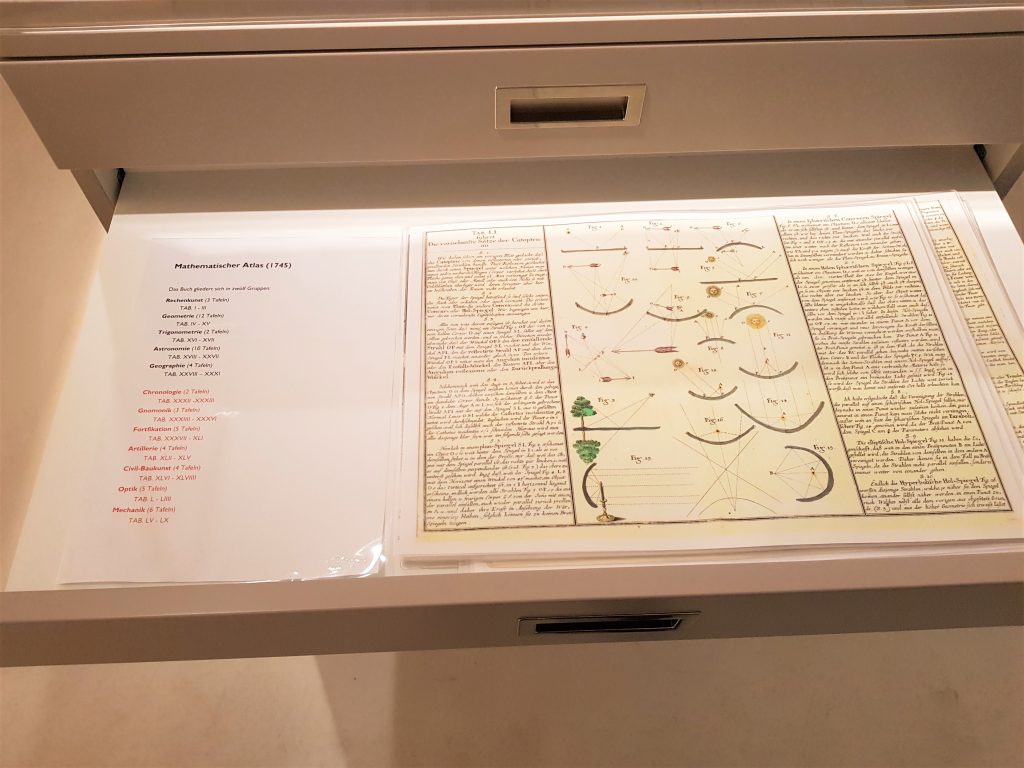
In his Mathematical Atlas, Mayer presented the entire knowledge of mathematics of his time. He had familiarized himself with mathematics by himself, which, among other things, led to the fact that he gave a lot of space to the illustrations on each page. In this way, he was also able to illustrate complicated facts.
The book is divided into 12 sections, each with several pages:
In drawer 1 (top):
1. Arithmetic (3 pages)
2. Geometry (12 pages)
3. Trigonometry (2 pages)
4. Astronomy (10 pages)
5. Geography (4 pages)
In drawer 2:
6. Chronology (2 pages)
7. Gnomonic (sundials, 3 pages)
8. Fortification (5 pages)
9. Artillery (4 pages)
10. Civil architecture (4 pages)
11. Optics (5 pages)
12. Mechanics (6 pages)
This book therefore not only introduces mathematics in the narrower sense, but also what we would call „applied mathematics“ today. He was in line with the trend of his time. His role model was Christian Wollf, whose main work on mathematics was structured in a similar way.
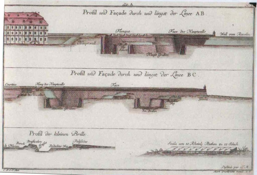
| Fortification book Tobias Mayer initially wanted to join the military service after finishing school. As a penniless orphan, he had no opportunity to study at a university and hoped to pursue his mathematical inclinations as a military engineer. In order to prove his qualification in this subject, he compiled an extensive book on fortress construction (fortification). It shows different ways of creating fortresses in floor plans and side views in Italy, the Netherlands and France, for example. In particular, the French fortress builder Vauban is represented with several of his „manners“ of building fortresses. |
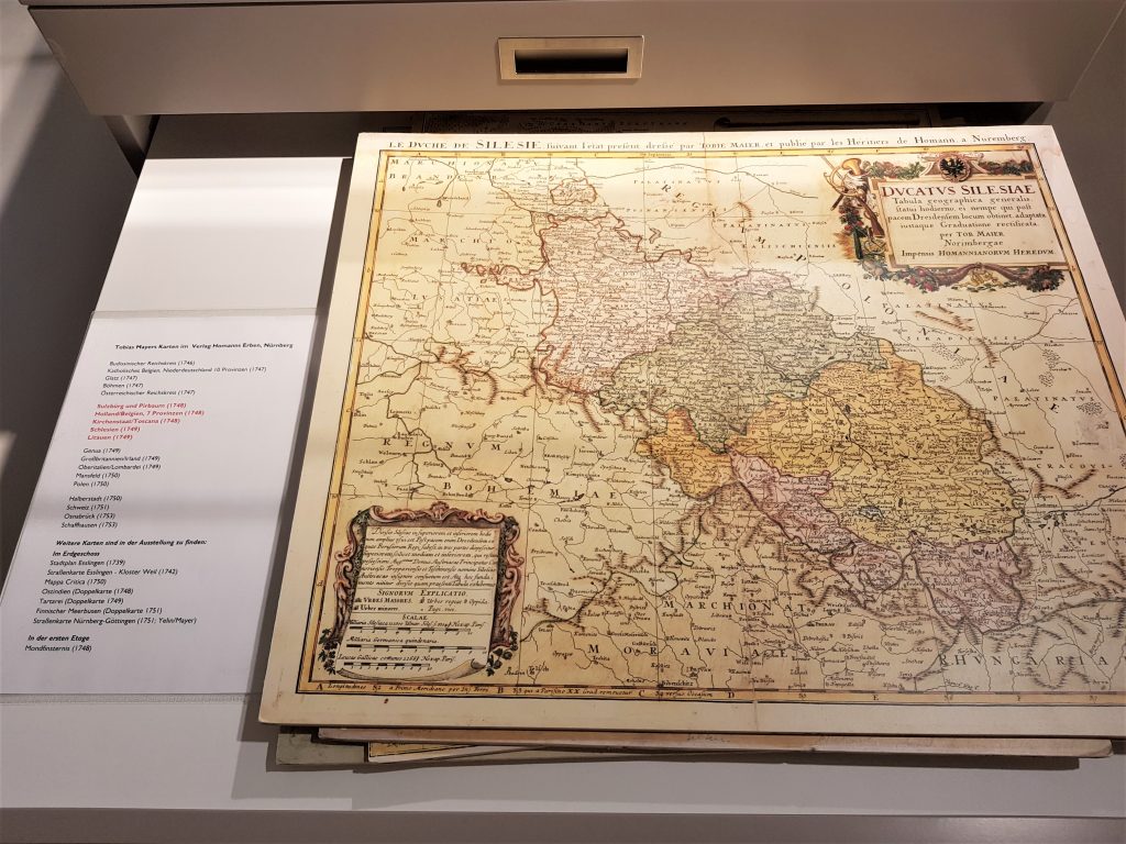
| Maps During his time in Nuremberg as a cartographer at the Homanns Erben publishing house, Tobias Mayer published over 40 maps. In the drawers you will find: Drawer 1: Budissin Empire Circle (1746), Catholic Belgium, Lower Germany 10 Provinces (1747), Glatz (1747), Bohemia (1747), Austrian Circle (1747) Drawer 2: Salzbuerg and Pirbaum (1748), Holland / Belgium, 7 provinces (1748), Papal States / Toscana (1748), Silesia (1749), Lithuania (1749) Drawer 3: Genoa (1749), Great Britain / Ireland (1749), Upper Italy / Lombardy (1749), Mansfeld (1750), Poland (1750) Drawer 4: Halberstadt (1750), Switzerland (1751), Osnabrück (1753), Schaffhausen (1753) Further maps can be found in the exhibition: On the ground floor: City map Esslingen (1739), road map Esslingen – Weil monastery (1742), Mappa Critica (1750), East India (double map (1748), Tartarei (double map 1749), Gulf of Finland (double map 1751), road map Nuremberg-Göttingen (1751 ; Yelin / Mayer) On the first floor: lunar eclipse (1748) |